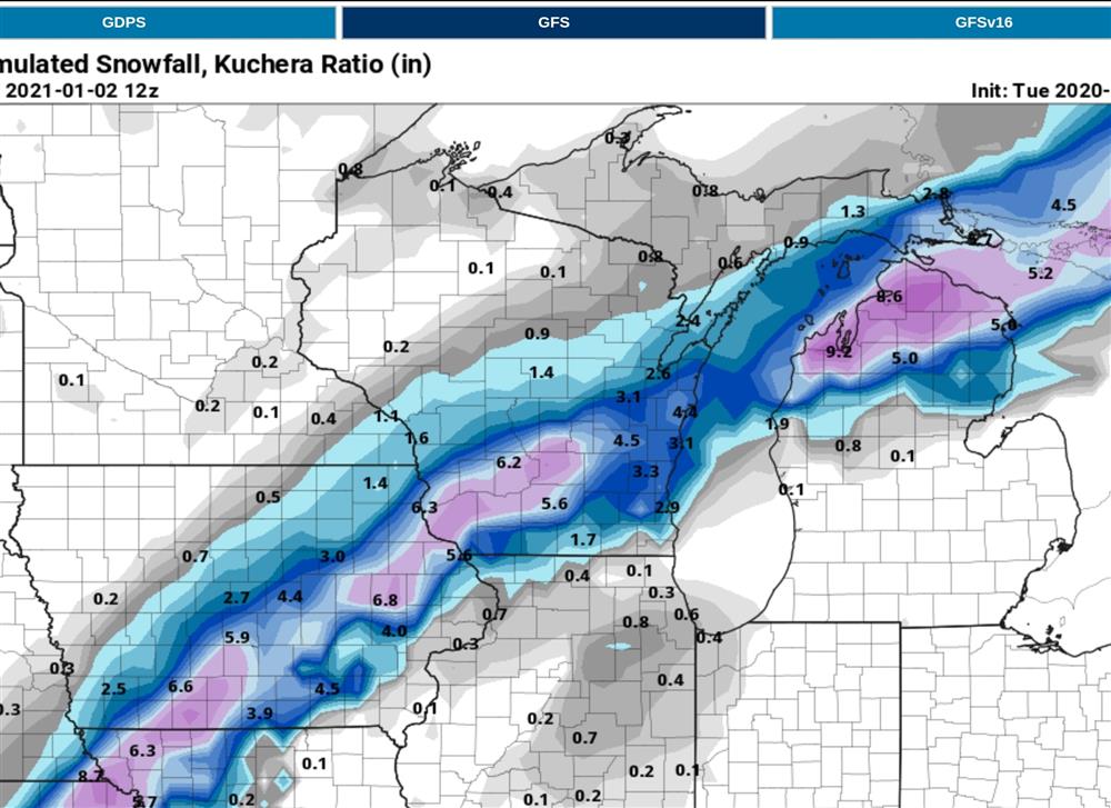
MON 10:40PM - 00zGFS was more aggressive with FRIDAY/SAT AM system. All medium range models look very much alike now (especially w/ precip type evolution from mix to snow). Typical differences in details such as snow amts. Here is an example of what snow totals MIGHT look like FRI-SAT AM. Probably mixed with sleet initially.

00z GFS snowfall prediction for FRI JAN 1
MON 12/28 2:43pm - Toned down the verbiage for the FRI New Years Day system. At high level this looks like a significant weather maker for the central US heading into southern WI. GFS trended closer to the EC today increasing probability there will be snow/mix/rain Friday. Looking at measurables i.e snowfall, not real impressive. A few reasons for that; strong warm surge. Top-down cooling. Narrow zone of snow accumulation with mix or rain in far southern WI. With TUES PM system dominating the storyline will wait another day before getting into detail.
12/27/2020 - 10:27pm -18/00z GFS continues to be weaker with winter storm potential. It's own ensembles are all over the place. Not placing much confidence in it. Looking forward to the 00z EC.
12/27/2020 - 8:11am - Initially looked like this storm would stay well east. Recent models trends put Wisconsin on the receiving end yet again, some models more than others. Model consistency is poor/bad with considerable timing and track disagreement. Before I speculate on impacts I will wait for models to settle down. Stay tuned.