SUN 7:58AM - Couple observations this am. Heavier snow bands did not translate northward thru southern WI like modeled. This leaves us with a large swatch of slowly accumulating light snow. Forecast looks fine elsewhere.
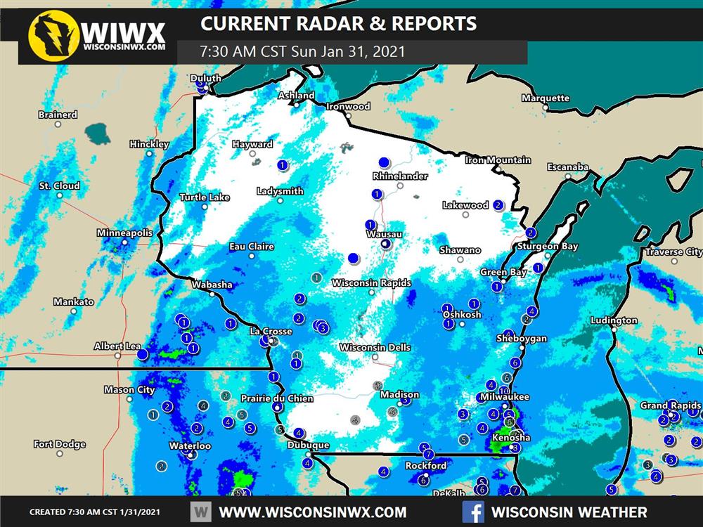
NOT impressed with snow reports this AM in southern WI. Still snowing and hopefully we close the gap.
SAT 8:27AM - INCREASED SNOW TOTALS. Went with 4-7" zone in southern WI supported by all models. I still feel 1-3" is a safe bet up there. Hope it works out!
SAT 12:30AM - latest EC supports prior statements with a nod towards more snow in WI.
FRI 10:33PM - Looking at the 00z model update tonight. Strong support of a 3-6", perhaps even 4-7" swath across all of southern Wisconsin. Certainly snowier than earlier predictions. I'm comfortable with 3-6". Curious see the new ECMWF tonight.

00NAM latest snowfall prediction showing 4-7" across all of southern WI. Increases in northern WI too.
FRI 1:34PM - Video Forecast
FRI 8:19AM - latest models trending snowier across Wisconsin. Moved the 3-6"& 1-3" zones further north from yesterday's forecast. Trimmed 6-9" along WI/IL border but kept it right along Lake Michigan in SE WI where Lake enhancement is expected into Sunday AM. Will have a video update this afternoon. Stay tuned and thank you!
THU 2:54PM - Map posted below. Working on development w/limited time so no forecast discussion today. Will shoot for an update on Friday. Thanks